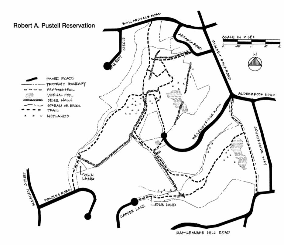
Robert Pustell Reservation
|
Features:
Glaciers that covered Andover shaped the topography of the property. The gently rolling terrain encompasses wetlands and certified vernal pools. For generations neighborhood children have delighted in exploring the steep granite cliffs, hidden caves, vernal pools, and identifying the ghost, mitten, and football shaped leaves of the sassafras trees. Deer, fox, and many other smaller animals are still seen by hikers. History: This property is named for Robert A. Pustell, an avid environmentalist and member of Andover’s Conservation Commission for over 25 years, who worked tirelessly to preserve open space for the enjoyment of all Andover citizens. In the early 1900s, The Henry Jenkins Trust owned much of this property. Starting in 1921, the various parcels were sold for development, the most recent being the 1995 sale of 106 acres to the Regency Ridge development. The Conservation Commission obtained the various pieces of land that make up the Pustell Reservation through land purchases and donations of open space (conservation easements) from developers. Much of this area had been farmland at one time, including a pig farm that practiced an early form of recycling – the farmer drove to his neighbors’ houses to collect food scraps for the pigs. This land was also used in days past by Native Americans, evidenced by artifacts found on the property. By legend, a resident of the Indian settlement on the Ballardvale site of the Jenkins’ house died of smallpox and is buried amongst the cliffs of this property. Suggested Walks: Check out the great new entrance trail on Powers Road, enhanced by a bridge constructed during a Summer 2010 Eagle Scout project. After crossing the bridge, follow the trail as it bears left, eventually intersecting the main trail network. Also, multiple different road access points provide several ways to thru-hike the Reservation. These include hiking from Ballardvale Road to Powers Rd. via an old woods road to stream crossing, eventually crossing new boardwalk bridge mentioned above and out to Powers Road; Arcadia Rd. to Regency Ridge; and Regency Ridge to Powers Road. Other combinations and many side trails in this extensively wooded and hilly reservation offer fantastic opportunities for exploring. Size: 84 acres Location: Ballardvale Road; Arcadia Road; Regency Ridge Road cul-de-sac; wood road continuation of Sunset Rock Road; Carter Lane cul-de-sac (at the gate, the trail goes to the right into the woods); Powers Road Parking: Regency Ridge Road; Arcadia Road; Carter Lane; Powers Road |

