• Our Town Trails
    • Andover Trails Guide, 6th edition
    • Bay Circuit Trail
    • Shawsheen River Greenway
    • Bicycle Routes
    • Andover Conservation Commission Land >
      • Abbot Bridge Drive
      • Bellevue Reservation
      • Carmel Woods
      • Castle Park
      • Dale Street
      • Doyle Link
      • Lightning Tree Reservation
      • Mary French Reservation
      • Haggett's Pond & Rail Trail
      • Virginia Hammond Res.
      • Merrimack River Reservation
      • Penguin Park
      • Pole Hill
      • Pomp's Pond/Foster's Island
      • Robert Pustell Reservation
      • Serio's Grove Reservation
      • Shawsheen Pines
      • West Elementary School Woods
      • Wood Hill/Bald Hill
    • AVIS Reservations
    • Massachusetts DCR
    • Town of Andover Land >
      • Fish Brook
      • Penguin Park
      • Sanborn School Woods
      • South School Woods
      • West Elementary School Woods
    • Trustees of the Reservations
    • Other Land >
      • Cochran Wildlife Sanctuary
      • Den Rock Park
      • West Parish Cemetery
  • Shawsheen River
    • Paddle Your Shawsheen
    • Where to Paddle >
      • Dale St - Central St (Abbot Bridge Dr)
      • Shawsheen Pines - Serio's Grove - Ballardvale
      • Shawsheen Pines - Sanborn Reservation (Tewksbury)
    • Safety & Areas to Avoid
    • Water Levels
    • History
  • Activities
    • Events Calendar
    • Hiking
    • Paddling
    • Fishing and Hunting
    • Biking
    • Events >
      • Past Events
  • Projects
    • Dam Removal Projects
    • RHC
    • River Crew
    • Bellevue Project
    • Bay Circuit Trail Bridge Project
    • Skug River Beaver Re-routes
  • Volunteer
  • Donate
  • About
    • Board
    • Affiliates
    • News
    • Contact
  • News
  • Andover to Everest
  ANDOVER TRAILS LIVE
  • Our Town Trails
    • Andover Trails Guide, 6th edition
    • Bay Circuit Trail
    • Shawsheen River Greenway
    • Bicycle Routes
    • Andover Conservation Commission Land >
      • Abbot Bridge Drive
      • Bellevue Reservation
      • Carmel Woods
      • Castle Park
      • Dale Street
      • Doyle Link
      • Lightning Tree Reservation
      • Mary French Reservation
      • Haggett's Pond & Rail Trail
      • Virginia Hammond Res.
      • Merrimack River Reservation
      • Penguin Park
      • Pole Hill
      • Pomp's Pond/Foster's Island
      • Robert Pustell Reservation
      • Serio's Grove Reservation
      • Shawsheen Pines
      • West Elementary School Woods
      • Wood Hill/Bald Hill
    • AVIS Reservations
    • Massachusetts DCR
    • Town of Andover Land >
      • Fish Brook
      • Penguin Park
      • Sanborn School Woods
      • South School Woods
      • West Elementary School Woods
    • Trustees of the Reservations
    • Other Land >
      • Cochran Wildlife Sanctuary
      • Den Rock Park
      • West Parish Cemetery
  • Shawsheen River
    • Paddle Your Shawsheen
    • Where to Paddle >
      • Dale St - Central St (Abbot Bridge Dr)
      • Shawsheen Pines - Serio's Grove - Ballardvale
      • Shawsheen Pines - Sanborn Reservation (Tewksbury)
    • Safety & Areas to Avoid
    • Water Levels
    • History
  • Activities
    • Events Calendar
    • Hiking
    • Paddling
    • Fishing and Hunting
    • Biking
    • Events >
      • Past Events
  • Projects
    • Dam Removal Projects
    • RHC
    • River Crew
    • Bellevue Project
    • Bay Circuit Trail Bridge Project
    • Skug River Beaver Re-routes
  • Volunteer
  • Donate
  • About
    • Board
    • Affiliates
    • News
    • Contact
  • News
  • Andover to Everest

About Andover Trails

About Andover Trails

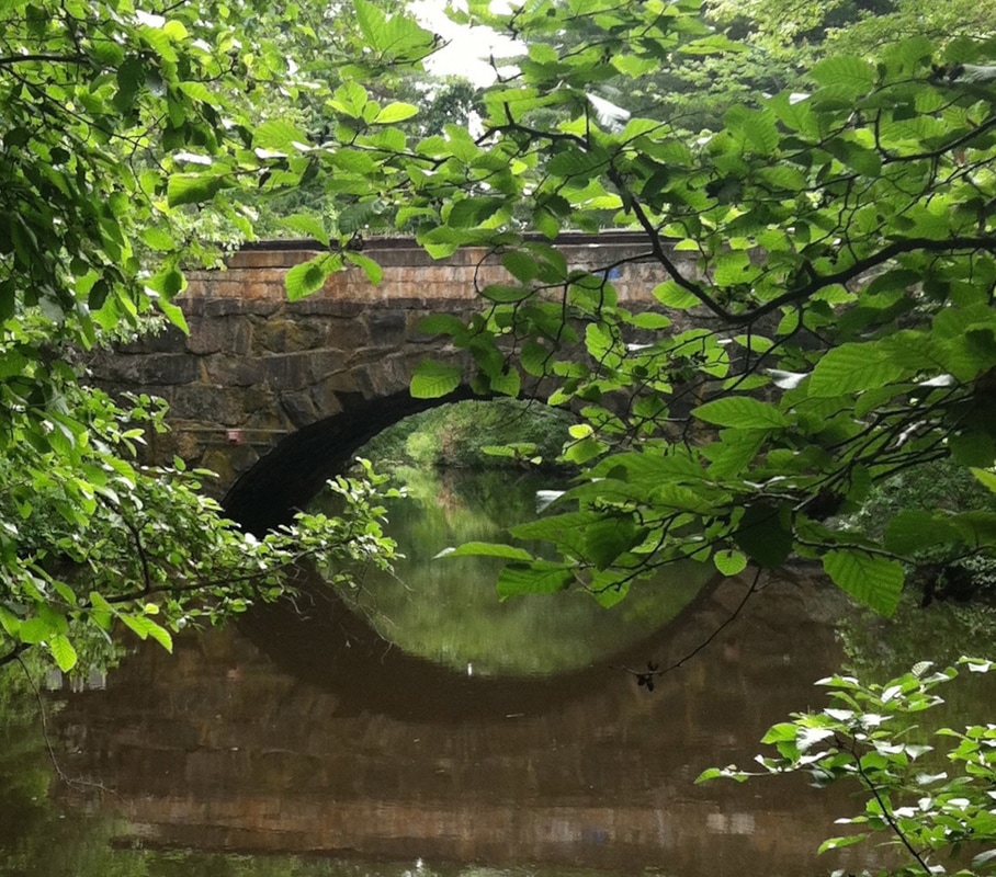
The Shawsheen River is a 27-mile-long tributary of the Merrimack River. Its headwaters are in Bedford (within the boundaries of Hanscom Field/Air Force Base) and runs generally northward through Billerica, Wilmington, Tewksbury, and Andover before joining the Merrimack in Lawrence -- six towns total. The name has had various spellings over the years. Shawshin appears to have been most common in the oldest records and is most commonly translated from the Algonquin language as "Great Spring."
Picture
Picture
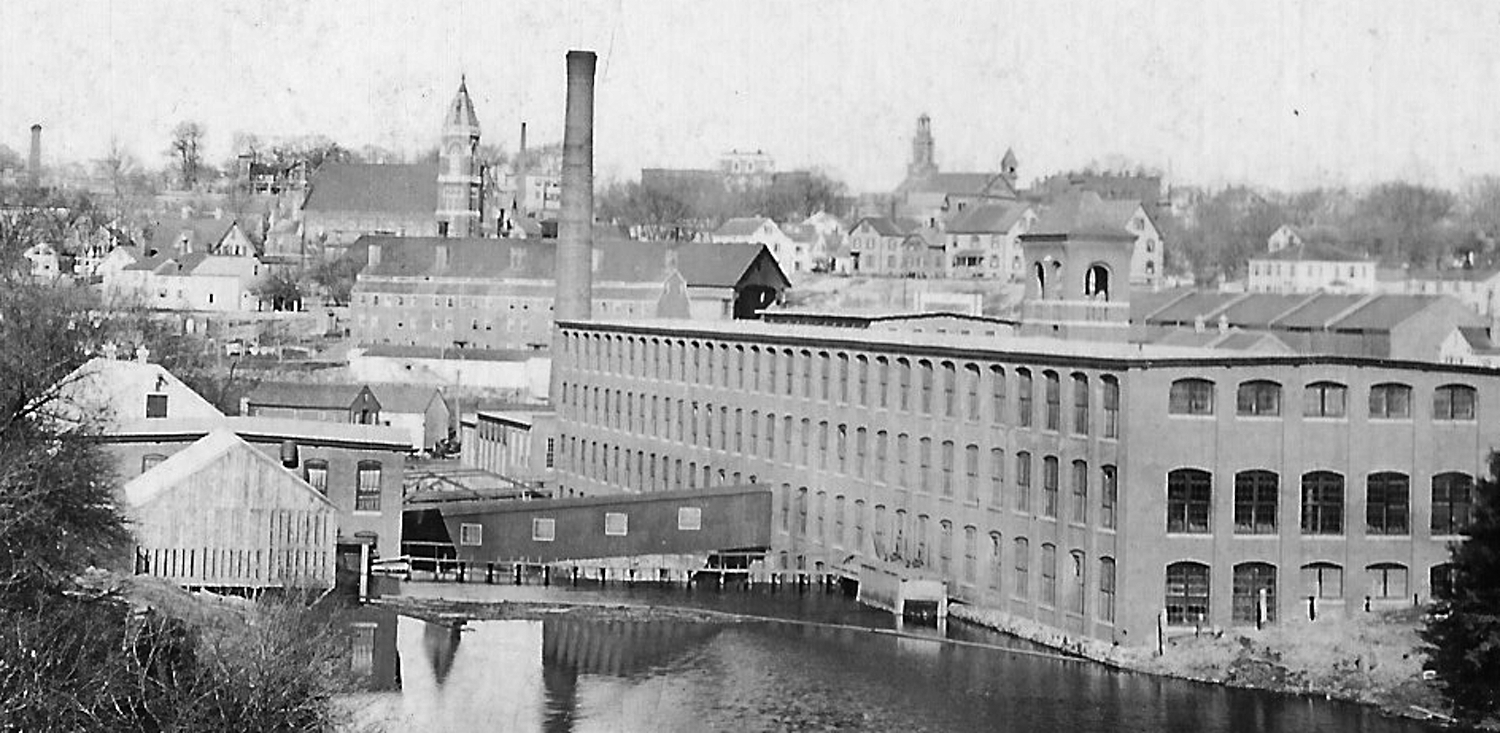
Many of Andover's 17th century English settlers moved from the town's original center (in modern North Andover) to the banks of the Shawsheen River to harness its power for grist, saw and fulling mills. As homes, flourishing farms and dams were built, South Parish gradually became the more populated half of the colonial town. By the middle of the 19th century and the time of the political division of North Andover and Andover, prosperous textile mills operated along the river in Ballardvale, Abbot Village (Smith and Dover in what is now Dundee Park), Marland Village (now Atria Marland Place on Stevens Street) and Frye Village (now Shawsheen). The Shawsheen River was Andover's economic "spine" and the source of most of the town's wealth, prosperity and philanthropy. 
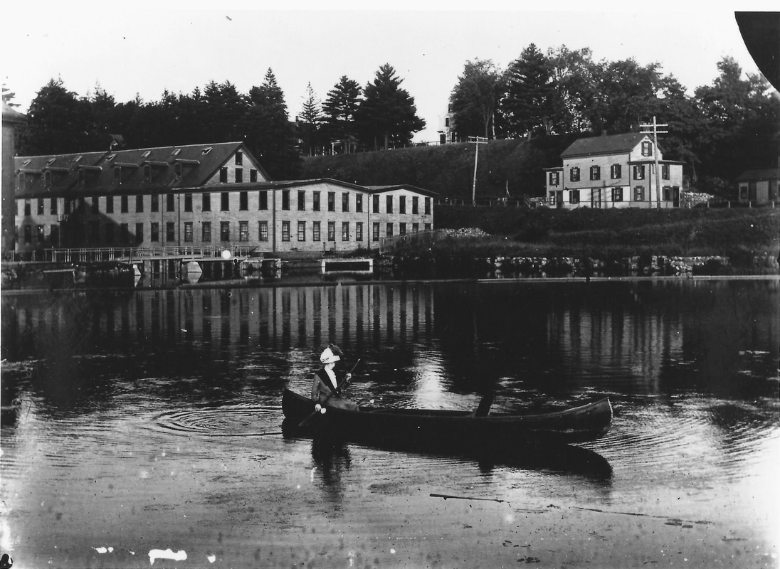
Late in the 19th century, the Shawsheen became an important recreational resource as well. Families, usually from towns closer to Boston, built "camps" or small vacation houses in Ballardvale and around Foster's Pond The Boston and Maine railroad brought large groups of excursionists to its Shawsheen Grove picnic grounds and dance hall at Pole Hill in Ballardvale.
Picture
Picture
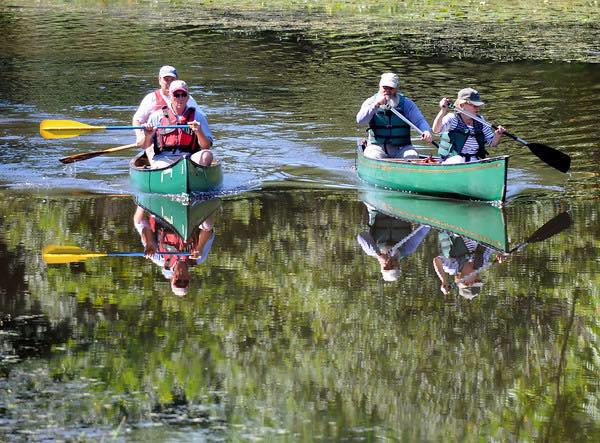
Canoes were available for rent at several establishments along the right. The Andover Canoe Club built a boathouse on Central Street near the Hartwell Abbot Bridge and hand-dug a half-mile-long canal (about 1913) linking the river to Pomps Pond. The club hosted regattas, torchlight parades of decorated boats, holiday and dance parties. The motor yacht "William Ballard" with only a ten-inch draft, carried up to thirty passengers to the pond for picnic suppers (1916). Further down the river, recreational river activities were included in American Woolen Company president, William Wood's, 1918-1924 development of Shawsheen Village.

EVENTS

VOLUNTEER

PROJECTS

DONATE

CONTACT

Copyright © 2018
  • Our Town Trails
    • Andover Trails Guide, 6th edition
    • Bay Circuit Trail
    • Shawsheen River Greenway
    • Bicycle Routes
    • Andover Conservation Commission Land >
      • Abbot Bridge Drive
      • Bellevue Reservation
      • Carmel Woods
      • Castle Park
      • Dale Street
      • Doyle Link
      • Lightning Tree Reservation
      • Mary French Reservation
      • Haggett's Pond & Rail Trail
      • Virginia Hammond Res.
      • Merrimack River Reservation
      • Penguin Park
      • Pole Hill
      • Pomp's Pond/Foster's Island
      • Robert Pustell Reservation
      • Serio's Grove Reservation
      • Shawsheen Pines
      • West Elementary School Woods
      • Wood Hill/Bald Hill
    • AVIS Reservations
    • Massachusetts DCR
    • Town of Andover Land >
      • Fish Brook
      • Penguin Park
      • Sanborn School Woods
      • South School Woods
      • West Elementary School Woods
    • Trustees of the Reservations
    • Other Land >
      • Cochran Wildlife Sanctuary
      • Den Rock Park
      • West Parish Cemetery
  • Shawsheen River
    • Paddle Your Shawsheen
    • Where to Paddle >
      • Dale St - Central St (Abbot Bridge Dr)
      • Shawsheen Pines - Serio's Grove - Ballardvale
      • Shawsheen Pines - Sanborn Reservation (Tewksbury)
    • Safety & Areas to Avoid
    • Water Levels
    • History
  • Activities
    • Events Calendar
    • Hiking
    • Paddling
    • Fishing and Hunting
    • Biking
    • Events >
      • Past Events
  • Projects
    • Dam Removal Projects
    • RHC
    • River Crew
    • Bellevue Project
    • Bay Circuit Trail Bridge Project
    • Skug River Beaver Re-routes
  • Volunteer
  • Donate
  • About
    • Board
    • Affiliates
    • News
    • Contact
  • News
  • Andover to Everest